Disneyland Ephemera Time & Happy Thanksgiving
Happy Thanksgiving, everyone!
It's time for some vintage Disneyland ephemera. Some of the most numerous souvenirs from ye olden days are the souvenir maps given to the visitors to Tom Sawyer Island. They were given out for free - passers-by could grab one (or two or five) from a handy bin (I have a photo in which you can see one of these bins, but I'll be damned if I can recall when it was posted). There are probably at least a dozen on eBay right now, so they're not rare. However, I still thought it would be fun to look at the different versions.
Here's the front of the very first map, circa 1956. It's a bit harder to find compared to the later versions, but you can still pick one up for a low price.
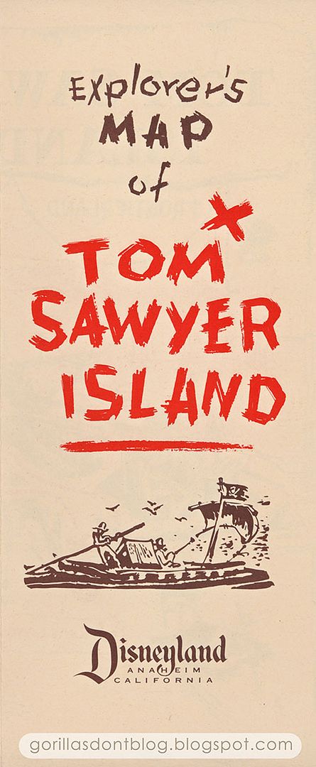
As with all of these brochures, it opens to reveal a wonderful map of the island. I'm guessing that this map was drawn before many features of the island were completed - or maybe it's just plain inaccurate. But it's still great! Notice that there is no "Tom's Treehouse", no pontoon bridge, and none of the playful rock features, such as "Teeter-totter Rock" or "Merry-go-round Rock". I am assuming that Sam McKim drew Tom and Huck, if not the map itself (he was responsible for those early "fun maps", so he probably did this one too). Please correct me if I'm wrong!

And here's the whole other side, for those who are interested!

In 1957, they released this familiar design with green and brown ink. It is much like its predecessor, with a bit of added copy to entice guests.
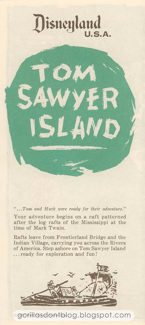
Inside is a whole new map - it reminds me of the kind one might find on the end papers of a vintage illustrated book. The higher angle gives you a better sense of the place. There's Tom's Treehouse - we are informed that it was the "highest point in Disneyland" - and the Pontoon Bridge, along with the rock features can now be seen; next to the fort, you can see the escape tunnel. The map also indicates two paths for rafts, one at the southern end of the island, and another at Huck's Landing, near the fort.

Reading! If I wanted to read I would go to the liberry.

A later version of the map is still dated 1957, but is clearly post-1959 because the Matterhorn became the highest point in Disneyland, and Tom's Treehouse lost its lofty status. Notice that the foliage was changed to a dark green to make the various trails easier to see. And the raft that headed to Huck's Landing is no longer indicated. This is the most common version of TSI maps.

And finally, just because I happened to have it, here's a scan of the map from Tom Sawyer Island at Tokyo Disneyland. It seems to be a bit condensed, and is definitely rearranged, though it does have most of the important features that were in Anaheim, pre-Pirate's Lair.

I hope you have enjoyed this look at some vintage Disneyland stuff! Have a safe and wonderful Thanksgiving.

10 comments:
Major-
As common as these maps might be, they're still wonderful examples of Disneyland ephemera and so much fun to view. And what a great gathering place TSI would be for a 'private' family Thanksgiving get-together.
(Now - just where is that elusive grave yard, I ask you-??)
Thanks, Major - and a Happy Thanksgiving to all.
Yay, Tokyo Disneyland on Gorillas Don't Blog!
I have a very similar version of that third DL TSI map, but "Tom's Landing" had been moved over to the other side of the Old Mill. And the "Secret Escape From Fort" had been removed completely since that tunnel was sealed up in the seventies. Despite those changes, the map is still dated 1957, which is odd.
And I'm just now realizing that they swapped the entrance and exit of Injun Joe's Cave at some point. Did they do that when they moved the landing spot for the rafts?
I love the graphics on the 1956 TSI map. Now I want to go hunt for one on eBay. Wonderful set today. You can't go wrong with Disneyland ephemera. Thanks, Major.
Happy Thanksgiving to all!
Coolest ephemera I've ever seen. Thanks, Major and Happy Thanksgiving!
Nice work, Major. I've had all my questions from yesterday regarding the three streams at the treehouse answered thoroughly!
I had the third variant shown here. I loved how all of the various docks were named, as through they actually had a history. Now, I know they actually had a history. Interesting to see how the Fishing Pier and Catfish Cove are still marked, long, long after those names had a literal meaning.
TM!, I'm going to guess you're right about the date and reason for the IJC entrance swap. I remember it being at one side of the island in the '70s and the other end when I next visited in the '90s. I also remember it altered the experience; if my memories are correct (and not being conflated with the MK version), with the original entrance there was a bit of a build-up to the Chamber of the Bottomless Pit, wheras with the swapped entrances the Bottomless Pit was almost the first thing you ran into.
Thanks for a great Thanksgiving post, Major!
Awesome stuff, Major.
I haven't been commenting much lately, but I still stop by every day. This blog, and the community down here in the comments, are something I'm thankful for.
Nanook, say, TSI really would be a cool place to have a Thanksgiving dinner. Best of all, think of how much the park could charge for it!
TokyoMagic!, oh very cool. In all these years, it seemed as if most people I spoke to said there were three different TSI maps. Now I know that there is at least one more - something to look for!
K. Martinez, the 1956 maps don’t come up so often, but you’ll find one eventually. Hopefully for cheap!
Scott Lane, thanks!
Patrick Devlin, I see two streams on the maps, but not three. Still, if they answered all your questions, I’m glad.
Chuck, those are some interesting details about Injun Joe’s Cave - none of which I knew about. Swapping the entrance points seems kind of pointless, but I suppose somebody had their reasons.
Mark H. Besotted, I’m glad you still check in!
I forgot to wish everyone a very happy Thanksgiving!
Major, I found my TSI maps. I have two different versions. The map portion on both maps is dated 1957, but the front panel/cover of the maps have two different codes indicating that they are probably from 1976. I do remember getting them around that time because it was a friend of mine that pointed out the box of maps on the post next to the entrance. Prior to that, I had been to the island, but didn't know that they provided free maps. One of the maps has the Secret Escape and the other doesn't, so I'm going to guess that 1976 is the year that they removed it. I'm sending you scans of both of those maps!
Hope you had a relaxing, happy Thanksgiving. As far as Tom Sawyers Island, I loved it back then, but my most vivid memory of it was when my friend hit his head on the low ceiling running through the cave. About '62 I think. Almost knocked himself silly. Took an hour or so before our parents let us run off again. I guess that's runnoft.
Post a Comment